|
>500 C
300 C
200 C
60 C
40 C
<40 C
|
 |
Pines Fire, San Diego
County
3 August 2002
As viewed by the FireMapper™
Thermal-Imaging Radiometer
Images were collected from the PSW Airborne
Sciences Aircraft and disseminated in part by satellite
communications in near-real time. FireMapper measures the
radiance of emitted thermal-infrared light, which readily
penetrates smoke. False-color images shown here depict the
apparent surface temperature (in Celsius) as estimated from
radiance and a simple black-body model. Warmer tones represent
recent or active combustion; areas of gray are cooling ash
or warm bare ground. Low temperatures of unburned forest
and cool ground are shown in green. Images have been geographically
referenced. Vertical exaggeration in 3-d views is 1.5 to
one unless otherwise noted.
|
|
Area Locator Map
|
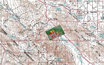
Click on the image above to view a larger JPEG image
|
|
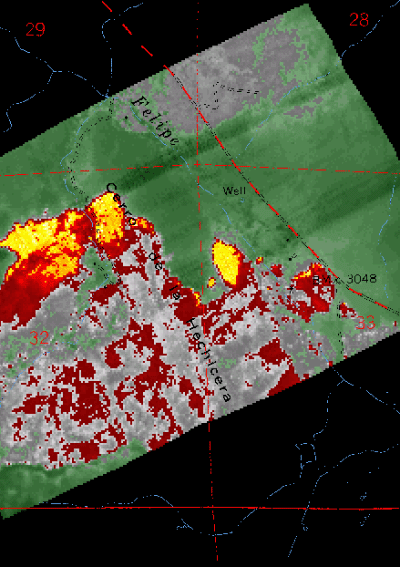
Image 1:
Ground surface temperatures as viewed from above at 11.9 micrometres
wavelength on 3 August 2002, at 3:47 pm.
Red and blue lines, black text are from a map overlay.
|
Click on the image above to view a larger JPEG image |
|
|
|
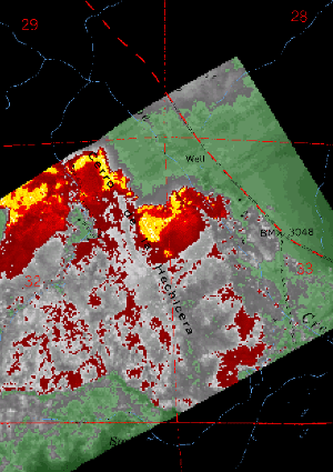
Image 2:
Ground surface temperatures as viewed from above at 11.9 micrometres
wavelength on 3 August 2002, at 4:13 pm.
Red and blue lines, black text are from a map overlay.
|
Click on the image above to view a larger JPEG image |
| |
|
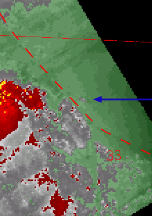
Image 3:
Zoomed view of Image 1, Highway S2 added in red dashed line.
Blue arrow points to area before the fire jumps the highway. |
Click on the image above to view a larger JPEG image |
| |
|
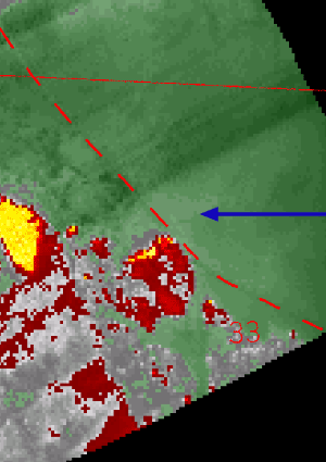
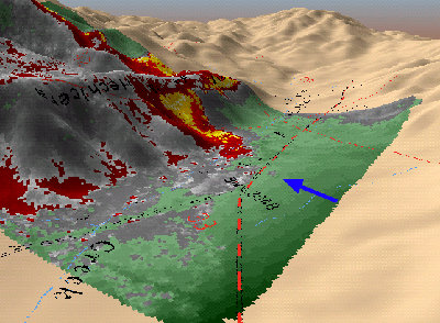
Image 4:
Zoomed view of Image 2, Highway S2 added in red dashed line.
Blue arrow shows hotspot after the fire jumps the highway. |
Click on the image above to view a larger JPEG image |
|
|
|
|
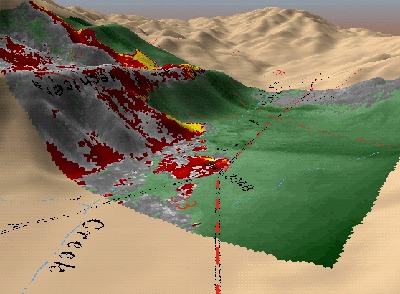
Image 5:
Topographic view as seen from the SE of Image 1.
|
Click on the image above to view a larger JPEG image |
|
|
|
|
Image 6:
Topographic view as seen from the SE of Image 2.
|
Click on the image above to view a larger JPEG image |


