|
Angeles National
Forest (San Dimas Experimental Forest)
8 July 2005
As viewed by the FireMapper™ system
in reflected red, near-InfraRed and thermal-InfraRed light
Images were collected
from the PSW Airborne Sciences Aircraft flying over the
area of the Williams Fire, north of Glendora.
|
| |
|
|
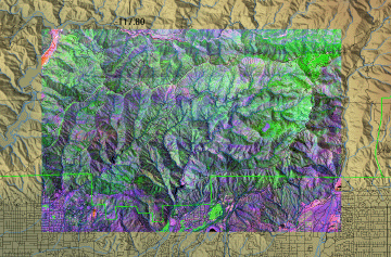
Location Map:
Shaded relief map of the Mt. Baldy, and Glendora quadrangles.
The color overlay shows the area of processed imagery.
|
Click on the image above to view a larger JPEG image
|
| |
|
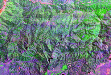
Image 1:
Image mosaic from north of Glendora.

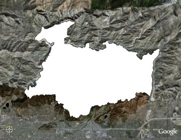
View a reduced-resolution version of this image as a Google Earth overlay.
|
Click on the image above to open a new browser window, then click to zoom in on a portion of that image.
Maximum resolution is 1.5 meters.
|
| |
|
|
View the Williams Fire perimeter as a Google Earth overlay.
|
View the Williams Fire perimeter as a Google Earth overlay. |
| |
|
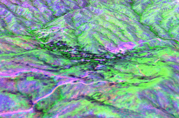
Image 2:
Perspective view from southwest of Tanbark Flat.
View a Google Earth placemark.
|
Click on the image above to open a new browser window.
|
| |
|
Image 3:
Perspective view from northwest of Brown's Flat. |
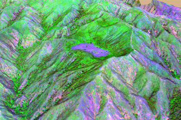
Click on the image above to open a new browser window.
|


