|
Old Faithful in Yellowstone NP
on the afternoon of October 12, 2006
As viewed by the FireMapper™ system
in reflected red, near-InfraRed and thermal-InfraRed light
|
|
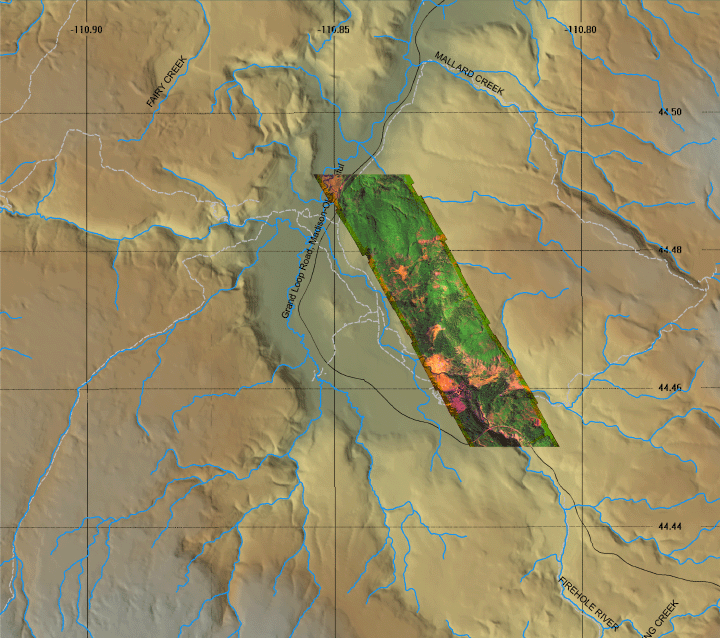
Click on the image above to view a larger Zoomify (JPEG) image with 3 meter resolution
(opens a new browser window)
Images were collected from the PSW Airborne Sciences Aircraft flying over the area near Old Faithful geyser at 16:09 MDT.
|
| |
|
Image 1:
Image mosaic from Old Faithful.
This RGB image shows reflected red light at 650 nm in red, reflected NIR at 850 nm in green, and thermal IR at 8 - 12 um in blue.
Download this image as a 1 meter-resolution TIFF.
|
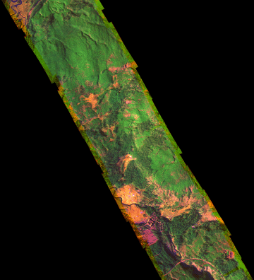
Click on the image above to view the full-resolution image
(opens a new browser window)
|
| |
|
| |
|
Image 1a:
Image mosaic from Old Faithful in a Google Earth overlay.

View the Geyser area in Google Earth.
Locations approximate, low resolution (4 m/pixel) version.
View the Geyser area in Google Earth.
Locations approximate, full resolution (.5 m/pixel) version. |
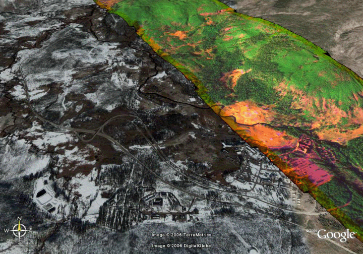
Click on the image above to view the full-resolution image
(opens a new browser window)
|
| |
|
Weather conditions at time of data collection :
from NOAA ROMAN system. |
BURRO HILL
Observation Time: 10/12/06 @ 15:40 MDT Elevation: 7166 ft.
For more info: BURRO HILL (ERAW4) OK
Temperature: 55 °F
Dew Point: 20 °F
Humidity: 25 %
Wind: WSW at 9 MPH
Peak Gust: 19 MPH
24 Hour Max/Min Events
Max Temperature: 55 °F
Min Temperature: 27 °F
Max RH: 93 %
Min RH: 25 %
Max Dew Point: 30 °F
Min Dew Point: 20 °F
Max Gust: 22 MPH
|


