|
|

|
 |
Fire Science |
|
|
Thermal mapping |
|
|
Mud Volcano in Yellowstone NP
on the night of October 12, 2006
As viewed by the FireMapper™ system
in Thermal-Infrared light
|
|
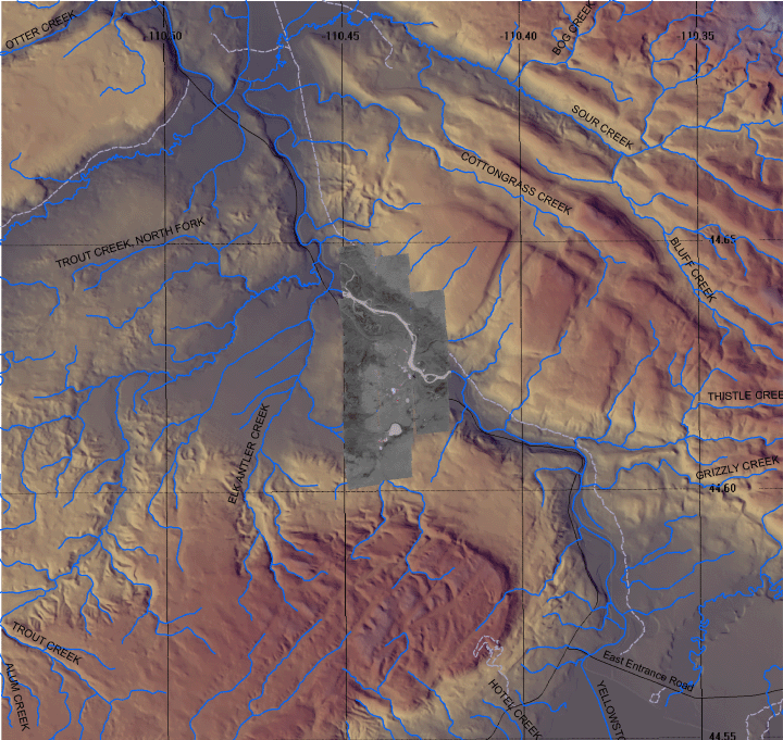
Click on the image above to view a larger Zoomify (JPEG) image with 6 meter resolution
(opens a new browser window)
Images were collected from the PSW Airborne Sciences Aircraft flying over the area of the Mud Volcano at 21:04 MDT.
|
| |
|
Image 1:
Image mosaic from Mud Volcano.
The mean surface temperature was just above freezing, 30 C is the break between the purple and the dark red and 75 C is the top of the red scale.
Download this image as a 2 meter-resolution TIFF.
|
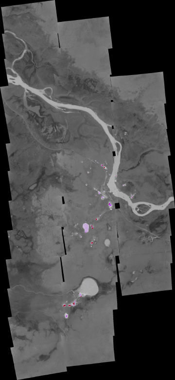
Click on the image above to view the full-resolution image
(opens a new browser window)
|
| |
|
Weather conditions at time of data collection :
from NOAA ROMAN system.
|
THRW4
Weather Conditions at October 12, 2006 - 20:10 MDT
|
20:10 |
24 Hour Max |
24 Hour Min |
| Temperature |
40.0° F |
52.0 at 15:10 |
27.0 at 8:10 |
| Dew Point |
21.4° F |
28.5 at 22:10 |
18.7 at 13:10 |
| Relative Humidity |
47% |
79 at 0:10 |
31 at 15:10 |
| Wind Speed |
6 mph from NNW |
12 at 13:10 |
0 at 3:10 |
| Wind Gust |
13 mph |
21 at 15:10 |
2 at 10:10 |
| Solar Radiation |
0.0 W/m*m |
760.0 at 13:10 |
0.0 at 21:10 |
| Fuel Temperature |
35.0° F |
57.0 at 14:10 |
24.0 at 8:10 |
| 10 hr Fuel Moisture |
14 gm |
16 at 22:10 |
14 at 14:10 |
| Battery voltage |
12.90 volt |
13.60 at 9:10 |
12.60 at 6:10 |
| Precipitation accumulated since midnight: 0.00", in 24 hours: 0.00" |
|
| |
|
| |
|
|
|
|
|
|
FireMapper™ has
been developed through a Research Joint Venture with Space Instruments,
Inc., and support from the National Fire Plan, Forest Service International
Programs, the U.S. Department of Agriculture, the Joint Fire Sciences Program, and the U.S. Agency
for International Development.
|