|
|
 |
 |
Fire Science |
|
Wildfire Monitoring and Prediction |
Fire Imaging |
|
Wolf Fire, Los Padres National Forest
6 to 12 June 2002
As viewed by the FireMapper™ Thermal-Imaging Radiometer
Images were collected from the PSW Airborne Sciences Aircraft and disseminated in part by satellite communications in near-real time. FireMapper measures the radiance of emitted thermal-infrared light, which readily penetrates smoke. Bright areas shown here are very hot ground associated with active fire fronts. Images have been geographically referenced. Vertical exaggeration in 3-d views is 1.5 to one unless otherwise noted.
|
|
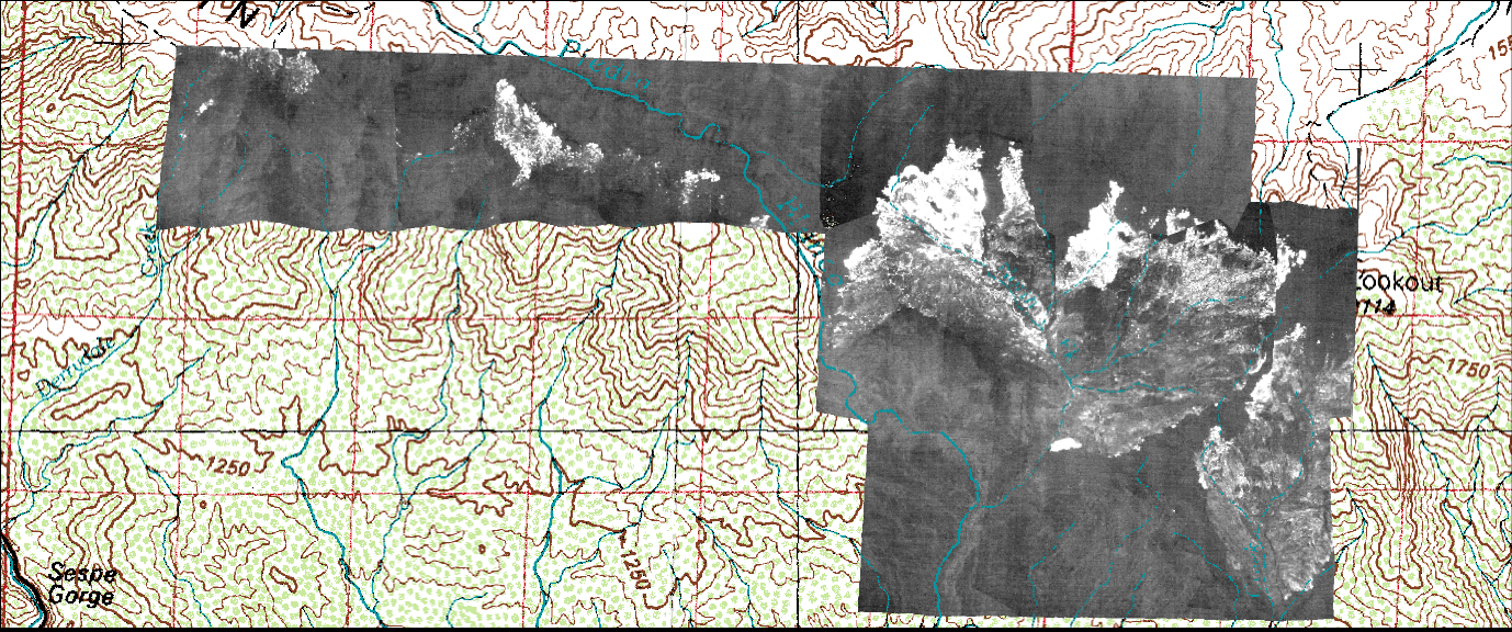
Image 1:
Ash layer, residual burning and spot fires at the Wolf Fire, 12 June 2002 |
|
|
Light gray tones are areas of ash warmed by solar heating. Dark gray tones are unburned vegetation. |
|
|
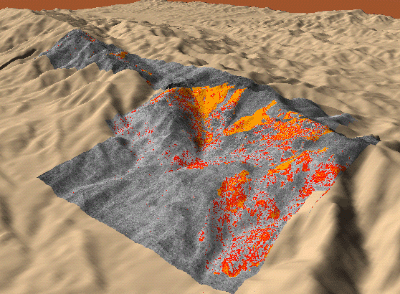
Image 2:
Topographic view of above image.

View the Wolf Fire in Google Earth.
Locations approximate.
|
|
|
|
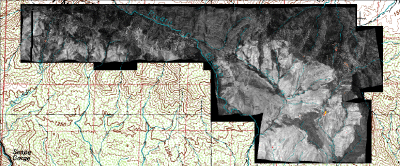
Image 3:
Wolf Fire, as viewed from above at 11.9 micrometers wavelength on 7 June 2002 |
|
|
Click on the image above to view a half-resolution GIF image |
| |
|
|
|
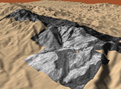
Image 4:
Topographic view from SE of above image, with the hotter areas colored red-orange |
|
|
Color-coded surface temperatures associated with active or recent burning in the Wolf Fire, 6 June 2002. |
|
|
Image 5:
Residual burning and spot fires at the Wolf Fire, 12 June 2002 |
|
|
Light gray tones are areas of ash warmed by solar heating. Dark gray tones are unburned vegetation. Red, orange, and yellow regions are residual burning. Latitude and longitude of hot spots may be obtained by opening the TIFF file in a suitable viewer such as Erdas Imagine. Postfire ash-surface temperatures may be indicative of the severity of burning. |
|
|
Image 6:
Topographic view of above image. |
|
|
|
|
|
| |
FireMapper™ has
been developed through a Research Joint Venture with Space Instruments,
Inc., and support from the National Fire Plan, Forest Service International
Programs, the U.S. Department of Agriculture, the Joint Fire Sciences Program, and the U.S. Agency
for International Development.
Disclaimer: Trade names, commercial products, and enterprises
are mentioned solely for information. No endorsement by the U.S. Department
of Agriculture is implied.
|