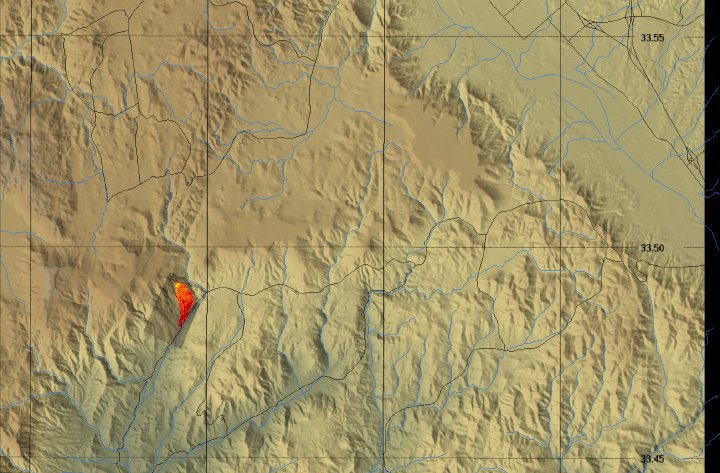
Colina Fire, Riverside County, CA
15:36 PDT 10 September 2007
As viewed by the FireMapper™ Thermal-Imaging Radiometer
|
|
Click on the image above to view a larger Zoomify image
or view the JPEG version
(opens a new browser window)
Current Image: Thermal mosaic
Ground surface temperatures as viewed from above at 11.9 micrometers wavelength on 10 September 2007, between 15:36 and 15:36 PDT.
|
| |
|
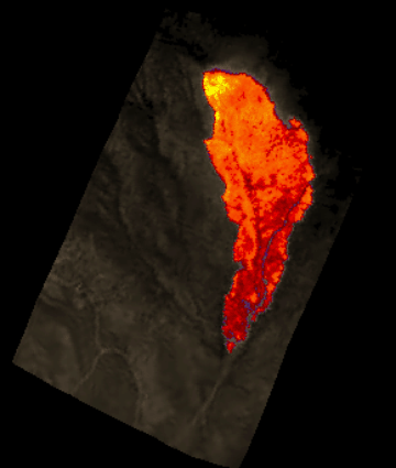
Image 1: Thermal Mosaic
Plan view of fire. Warmer tones represent recent or active combustion; areas of light gray are cooling ash or warm bare ground and the low temperatures of unburned forest and cool ground are shown in darker gray (see chart above).
|
Click on the image above to view a larger JPEG image
(opens a new browser window) |
|
|
|
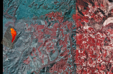
Image 2: Thermal Mosaic on DOQQ
Thermal image on Color IR Digital Orthoquad.
|
Click on the image above to view a larger JPEG image
(opens a new browser window) |
|
|
|
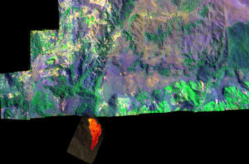
Image 3: Thermal Mosaic on FireMapper imagery
Thermal image on color composite of recent FireMapper imagery.
|
Click on the image above to view a larger JPEG image
(opens a new browser window) |
|
|
|
Firelines
|
|
|
|
|
Weather conditions at time of data collection :
from NOAA ROMAN system. |
Past Weather Conditions for KNFG
Observations prior to selected time: September 10, 2007 - 16:00 PDT
Weather Conditions at September 10, 2007 - 15:56 PDT
|
15:56 |
24 Hour Max |
24 Hour Min |
| Temperature |
79.0° F |
82.0 at 13:56 |
50.0 at 4:56 |
| Dew Point |
51.1° F |
57.0 at 17:56 |
46.9 at 4:56 |
| Wet Bulb Temperature |
62.0° F |
64.0 at 13:56 |
48.4 at 4:56 |
| Relative Humidity |
38% |
89 at 2:56 |
37 at 13:56 |
| Wind Speed |
16 mph from SSW |
16 at 14:56 |
0 at 19:56 |
| Wind Gust |
- |
22 at 14:56 |
18 at 13:56 |
| Pressure |
29.82 in |
29.89 at 7:56 |
29.81 at 16:56 |
| Sea level pressure |
29.89 in |
29.97 at 9:56 |
29.88 at 16:56 |
| Altimeter |
29.90 in |
29.97 at 7:56 |
29.89 at 16:56 |
| 1500 m Pressure |
24.95in |
25.01 at 7:56 |
24.94 at 16:56 |
| Weather conditions |
clear |
- |
- |
| Visibility |
10.00 miles |
10.00 at 16:56 |
9.00 at 6:56 |
|