|
|
|
 |
Fire Science: Wildfire Monitoring and Prediction
|
|
Fire Imaging: Rice Fire |
|
|
|
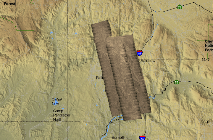
Rice Fire, San Diego County, CA
15:44 PDT 28 October 2007
As viewed by the FireMapper™ Thermal-Imaging Radiometer
|
|
Click on the image above to view a larger Zoomify image
or view the JPEG version
(opens a new browser window)
Ground surface temperatures as viewed from above at 8-12 micrometers wavelength on 28 October 2007, between 15:44 and 15:59 PDT.
|
| |
|
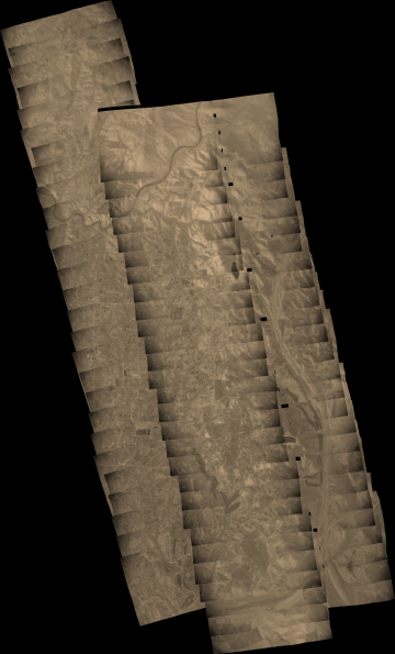
Image 1: Thermal Mosaic
Plan view of fire. Warmer tones represent recent or active combustion; areas of light gray are cooling ash or warm bare ground and the low temperatures of unburned forest and cool ground are shown in darker gray (see chart above).
All temperatures are below 60 C in this image.
|
Click on the image above to view a larger JPEG image
(opens a new browser window) |
|
|
|
Firelines
If link doesn't open in Google Earth or Google Maps, try saving the file to disk and running doc.kml from there. |
|
|
|
|
|
|
|
Weather conditions at time of data collection :
Oceanside station KNFG from NOAA ROMAN system. |
Past Weather Conditions for KNFG
Observations prior to selected time: October 28, 2007 - 16:00 PDT
Weather Conditions at October 28, 2007 - 15:56 PDT
|
15:56 |
24 Hour Max |
24 Hour Min |
| Temperature |
82.0° F |
89.1 at 12:56 |
48.0 at 6:56 |
| Dew Point |
50.0° F |
55.9 at 20:56 |
44.1 at 6:56 |
| Wet Bulb Temperature |
62.7° F |
65.6 at 13:56 |
46.0 at 6:56 |
| Relative Humidity |
33% |
86 at 2:56 |
26 at 12:56 |
| Wind Speed |
7 mph from SW |
13 at 14:56 |
0 at 16:56 |
| Pressure |
29.96 in |
30.07 at 8:56 |
29.96 at 14:56 |
| Sea level pressure |
30.03 in |
30.14 at 8:56 |
30.03 at 15:56 |
| Altimeter |
30.04 in |
30.15 at 8:56 |
30.04 at 14:56 |
| 1500 m Pressure |
25.07in |
25.16 at 8:56 |
25.07 at 14:56 |
| Weather conditions |
clear |
- |
- |
| Visibility |
9.00 miles |
10.00 at 18:56 |
9.00 at 16:56 |
| Ceiling |
- |
15000 at 17:56 |
10000 at 16:56 |
|
|
| |
FireMapper™ has
been developed through a Research Joint Venture with Space Instruments,
Inc., and support from the National Fire Plan, Forest Service International
Programs, the U.S. Department of Agriculture, the Joint Fire Sciences Program, and the U.S. Agency
for International Development.
|