|
|

|
 |
Fire Science |
|
|
Post-fire mapping |
|
|
Near Cleveland National
Forest (Matagual Valley)
4 June 2006
As viewed by the FireMapper™ system
in reflected red, near-InfraRed and thermal-InfraRed light
Images were collected
from the PSW Airborne Sciences Aircraft flying over the
area of the Mataguay Fire, south of Warners Ranch.
|
|
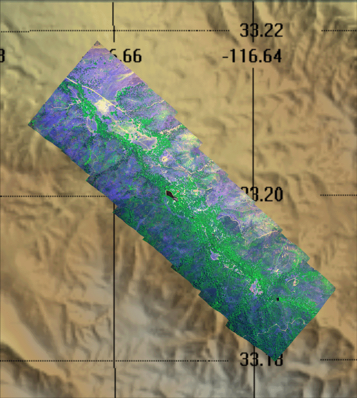
Click on the image above to view a larger Zoomify (JPEG) image with 1 meter resolution
(opens a new browser window)
|
| |
|
Image 1:
Image mosaic from south of Warners Ranch.

View this image of the Mataguay Valley as a Google Earth overlay.
Download this image as a full-resolution JPEG.
|
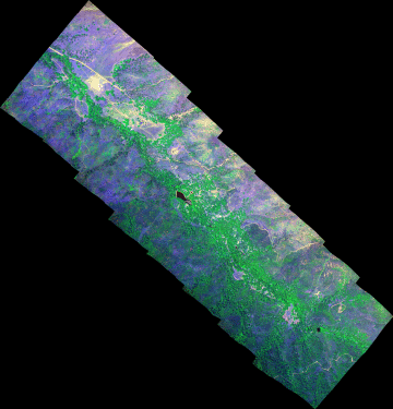
Click on the image above to view the full-resolution image
(opens a new browser window)
|
| |
|
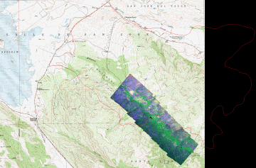
Image 2:
Plan view of imagery shown on topo map (DRG).
|
Click on the image above to open a new browser window.
|
| |
|
Image 3:
Perspective view from southeast of Matagual Valley. |
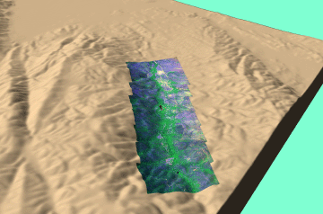
Click on the image above to open a new browser window.
|
| |
|
Image 4:
Plan view of imagery shown on topo map (DRG), with Mataguay Fire perimeter shown in red. |
Click on the image above to open a new browser window.
|
|
|
|
|
|
FireMapper™ has
been developed through a Research Joint Venture with Space Instruments,
Inc., and support from the National Fire Plan, Forest Service International
Programs, the U.S. Department of Agriculture, the Joint Fire Sciences Program, and the U.S. Agency
for International Development.
|


