Old Fire, San Bernardino NF
29 October 2003- repeat flights
As viewed by the FireMapper™
Thermal-Imaging Radiometer
Images were collected from the PSW Airborne
Sciences Aircraft and disseminated in part by satellite
communications in near-real time. FireMapper measures the
radiance of emitted thermal-infrared light, which readily
penetrates smoke. False-color images shown here depict
the apparent surface temperature (in Celsius) as estimated
from
radiance and a simple black-body model. Warmer tones represent
recent or active combustion; areas of gray are cooling
ash
or warm bare ground (see chart below). Low temperatures
of unburned forest and cool ground are shown in green.
Images have been geographically referenced. Vertical exaggeration
in 3-d views is 1.5 to one unless otherwise noted.
|
| |
|
| |
|
Fire Area Map
|
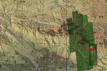
Click on the image above to view a larger JPEG image
(opens a new browser window) |
Fire Imagery
|
The following color-coded images depict apparent ground surface temperatures
in Celsius. Roads, streams, and the text in the background are from
a 1:250,000 topographic map.
|
|
Note:
These images were collected by sensors in a small aircraft
flying in turbulent Santa Ana wind conditions, and slight
shifts and rotations between images are to be expected.
When the individual images are spliced together into a
larger mosaic, errors in edge matching may result in duplication
of some points near the seam, and the loss of others in
the overlap area.
Do not depend on these images for accurate fireline locations.
Use the map backgrounds as a general location guide, and
look for recognizable terrain features or landmarks on
the imagery itself for relative positioning of hotspots.
Bodies of water, street grids, open fields, highways, ridgelines
and stream courses show up well in this imagery.
|
|
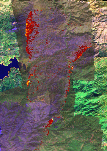
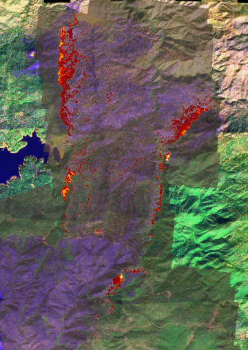
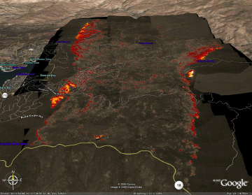
Image 1: Multi-pass
mosaic
Ground surface temperatures as viewed from above at 11.9 micrometers wavelength
on 29 October 2003, between 7:23 and 8:08 PM PST.
Link
to download full-resolution thermal data in geoTIFF zip
file. 3 MB file size.
|
Click on the image above to view a larger JPEG image
|
|
|
|
|
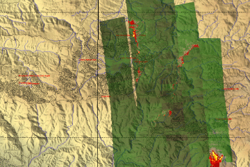
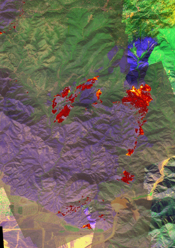
Image 2: Detail- north
Ground surface temperatures as viewed from above at 11.9 micrometers wavelength
on 29 October 2003, between 3:40 and 4:01 PM PST.
Background image is from 5 November, 2003
|
Click on the image above to view a larger JPEG image
|
| |
|
|
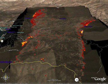
Image 2a:
Google Earth view
View from south, looking toward Lake Arrowhead on 29 October 2003, between 3:40 and 4:01 PM PST.

View this Old Fire image as Google Earth overlay
| 
Click on the image above to view a larger JPEG image
|
|
|
|
|
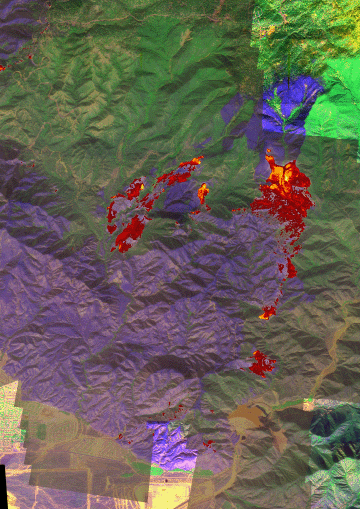
Image 3: Detail- south
Ground surface temperatures as viewed from above at 11.9 micrometers wavelength on 29 October 2003, between 3:40 and 4:01 PM PST.
Background image is from 5 November, 2003
|
Click on the image above to view a larger JPEG image
|
|
|
|
|
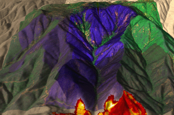
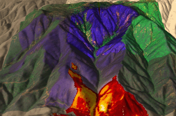
Image 3a: 3D
Perspective view from the south.
Background image is from 5 November, 2003.
No vertical exaggeration. |
Click on the image above to view a larger JPEG image
|
|
|
|
|
The following images are from repeat passes over the active firelines
|
|
|
Image 4: Detail- north
Ground surface temperatures as viewed from above at 11.9 micrometers wavelength
on 29 October 2003, between 4:09 and 4:14 PM PST.
Background image is from 5 November, 2003
|
Click on the image above to view a larger JPEG image
|
|
|
|
|
Image 4a: Detail- south
Ground surface temperatures as viewed from above at 11.9 micrometers wavelength on 29 October 2003, between 4:23 and 4:29 PM PST.
Background image is from 5 November, 2003
|
Click on the image above to view a larger JPEG image
|
| |
|
|
Image 4b:
Google Earth view
View from south, looking toward Lake Arrowhead on 29 October 2003, between 3:40 and 4:01 PM PST.
View this Old Fire image as Google Earth overlay
|
Click on the image above to view a larger JPEG image
|
|
|
|
|
Image 4c: 3D
Perspective view from the south.
Background image is from 5 November, 2003.
No vertical exaggeration. |
Click on the image above to view a larger JPEG image
|
|
|
|

 Piper Navajo remote sensing aircraft


