|
|
|
National Wildlife Refuge survey,
Tijuana Slough, San Diego
5 October 2005
As viewed by the FireMapper™
system
in reflected red, near-IR, and thermal IR frequencies
Images were collected
from the PSW Airborne Sciences Aircraft flying over the
area near San Ysidro.
|
|
|
|
Multi-spectral false-color image:
Download a zip file containing this image in geoTIFF format

View a reduced-resolution version of this Tijuana Slough image as a Google Earth overlay.
|
Click on the image above to view a Zoomify (JPEG) image in a new browser window
|
| |
Border Field State Park, the Tijuana River National Estuarine Research Reserve, and the Tijuana Slough National Wildlife Refuge are all located near the mouth of the Tijuana River in San Diego County. |
|
|
|
Location Map:
Plan view during during day (1:12 pm). |
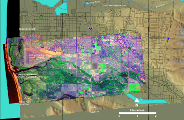
Click on the image above to view a larger JPEG image in a new browser window
|
| |
Healthy vegetation is bright green; stressed or dying vegetation is yellow-brown in this false-color depiction.
(This RGB image shows reflected red light at 650 nm in red, reflected NIR at 850 nm in green, and thermal IR at 8 - 12 um in blue. ) |
| |
|
Image 1:
Thermal IR view during day (1:12 pm). |
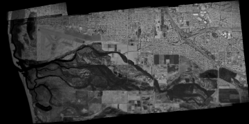
Click on the image above to view a larger JPEG image in a new browser window
|
| |
|
Image 2:
Thermal IR view during night (8:17 pm).
View a full-resolution version of this Tijunana Slough image as a Google Earth overlay.
|
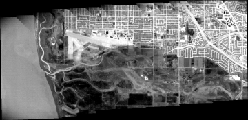
Click on the image above to view a larger JPEG image in a new browser window
|
| |
|
 Piper Navajo remote sensing aircraft