Roblar 2
Fire, San Diego County
23 October 2003
As viewed by the FireMapper™
Thermal-Imaging Radiometer
Images were collected from the PSW Airborne
Sciences Aircraft and disseminated in part by satellite
communications in near-real time. FireMapper measures the
radiance of emitted thermal-infrared light, which readily
penetrates smoke. False-color images shown here depict
the apparent surface temperature (in Celsius) as estimated
from
radiance and a simple black-body model. Warmer tones represent
recent or active combustion; areas of gray are cooling
ash
or warm bare ground (see chart below). Low temperatures
of unburned forest and cool ground are shown in green.
Images have been geographically referenced. Vertical exaggeration
in 3-d views is 1.5 to one unless otherwise noted.
|
| |
|
Location Map
Roblar 2 fire (courtesy of
wildfire.cr.usgs.gov/ca_geomac). Active fires are labeled in
white. |
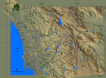
Click on the image above to view a larger JPEG image |
Fire Map
|
|
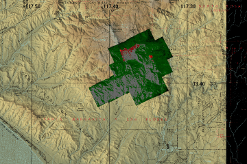
Click on the image above to view a larger JPEG image
(opens a new browser window)
|
| |
Fire Imagery
|
The following color-coded images depict apparent ground surface temperatures
in Celsius. Roads, streams, and the text in the background are from
a 1:100,000 topographic map.
|
| |
|
|
Image 1:
Ground surface temperatures as viewed from above at 11.9
micrometers wavelength on 23 October 2003, between 4:43
and 5:00 PM PDT.
|
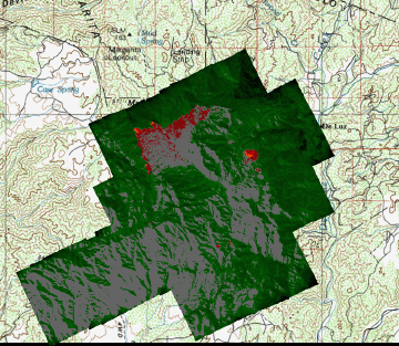
Click on the image above to view a larger JPEG image |
|
|
|
| Image 2:
Download link for geoTIFF zip file.
|
Click on the image above to download the zip file |
|
|
|
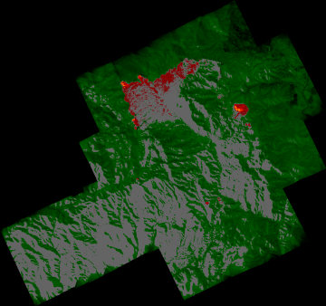
Image 3:
Topographic view as seen from the southeast of Image 1.
|
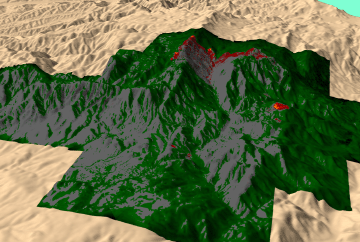
Click on the image above to view a larger JPEG image |
| |
|
|
|
Narrative
from the INCIDENT MANAGEMENT SITUATION REPORT
THURSDAY OCTOBER 23, 2003 - 0530 MDT. (Courtesy of www.nifc.gov.) |
ROBLAR 2, Camp Pendleton Marine
Corps Base. A Type 2 Incident Management Team
(Domanski) is assigned. This fire is in six foot tall chaparral,
six miles west of Fallbrook, CA.
Significant spread occurred along the southwest and northeast
flanks during periods of extreme fire
behavior. |
|
|
 Piper Navajo remote sensing aircraft


