|
Mud Volcano in Yellowstone NP
on the afternoon of October 12, 2006
As viewed by the FireMapper™ system
in reflected red, near-InfraRed and thermal-InfraRed light
|
|
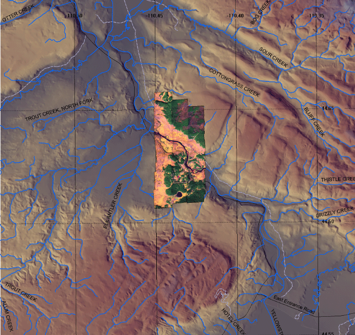
Click on the image above to view a larger Zoomify (JPEG) image with 6 meter resolution
(opens a new browser window)
Images were collected from the PSW Airborne Sciences Aircraft flying over the area of the Mud Volcano at 13:54 MDT.
|
| |
|
Image 1:
Image mosaic from the area of Mud Volcano.
This RGB image shows reflected red light at 650 nm in red, reflected NIR at 850 nm in green, and thermal IR at 8 - 12 um in blue.
Download this image as a .5 meter-resolution TIFF.
|
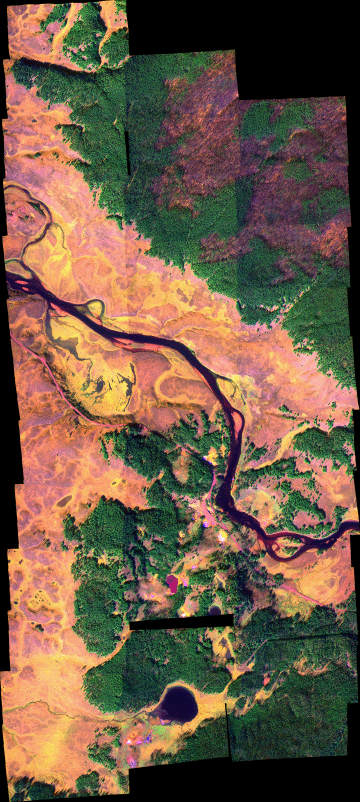
Click on the image above to view a larger Zoomify (JPEG) image with .5 meter resolution
(opens a new browser window)
|
| |
|
Image 2:
Image mosaic from Mud Volcano in a Google Earth overlay.

View the Geyser area in Google Earth.
Locations approximate, low resolution version. |
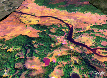
Click on the image above to view the full-resolution image
(opens a new browser window)
|
| |
|
Weather conditions at time of data collection :
ID: KP60
NAME: Yellowstone Lake
LATITUDE: 44.54444
LONGITUDE: -110.42111
ELEVATION: 7835 ft
MNET: NWS/FAA
from NOAA ROMAN system.
|
Past Weather Conditions for KP60
Weather Conditions at October 12, 2006 - 20:55 GMT
|
20:55 |
24 Hour Max |
24 Hour Min |
| Temperature |
50.0° F |
50.0 at 20:55 |
24.1 at 13:55 |
| Dew Point |
19.0° F |
30.9 at 0:55 |
19.0 at 20:55 |
| Wet Bulb Temperature |
36.4° F |
37.9 at 18:55 |
23.3 at 13:55 |
| Relative Humidity |
29% |
92 at 5:55 |
29 at 20:55 |
| Wind Speed |
3 mph from N |
10 at 22:55 |
0 at 0:55 |
| Wind Gust |
18 mph |
18 at 21:55 |
18 at 21:55 |
| Pressure |
22.50 in |
22.56 at 2:55 |
22.50 at 20:55 |
| Sea level pressure |
30.03 in |
30.19 at 2:55 |
30.03 at 20:55 |
| Altimeter |
30.10 in |
30.18 at 2:55 |
30.10 at 20:55 |
| 1500 m Pressure |
25.11in |
25.18 at 2:55 |
25.11 at 20:55 |
|
| |
|
| |
|