|
Norris Geyser Basin in Yellowstone NP
on the afternoon of October 12, 2006
As viewed by the FireMapper™ system
in reflected red, near-InfraRed and thermal-InfraRed light
|
|

Click on the image above to view a larger (JPEG) image
(opens a new browser window)
Images were collected from the PSW Airborne Sciences Aircraft flying over the area of the Norris Geyser Basin at 14:19 MDT.
|
| |
|
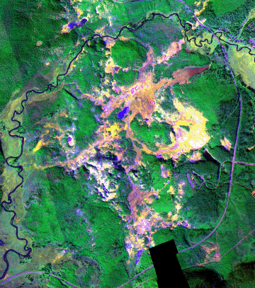
Image 1:
A portion of the image mosaic from Norris Geyser Basin.
This RGB image shows reflected red light at 650 nm in red, reflected NIR at 850 nm in green, and thermal IR at 8 - 12 um in blue.
Download this image as a .5 meter-resolution TIFF.
|
Click on the image above to view a larger Zoomify (JPEG) image with .5 meter resolution
(opens a new browser window)
|
| |
|
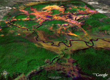
Image 1a:
Image mosaic from Norris Geyser Basin in a Google Earth overlay.

View the Geyser area in Google Earth.
Locations approximate, low resolution version (3 MB file).
View the Geyser area in Google Earth.
Locations approximate, FULL resolution version (100 MB file). |
Click on the image above to view the reduced-resolution image
(opens a new browser window)
|
| |
|
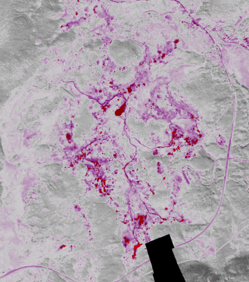
Image 2:
A portion of the thermal image mosaic from Norris Geyser Basin.
This false-color image shows thermal IR at 8 - 12 um in shades of purple and red.
Download this image as a .5 meter-resolution TIFF.
|
Click on the image above to view a larger Zoomify (JPEG) image with .5 meter resolution
(opens a new browser window)
|
| |
|
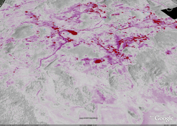
Image 2a:
Thermal image mosaic from Norris Geyser Basin in a Google Earth overlay.
View the Geyser area in Google Earth.
Locations approximate, FULL resolution version (40 MB file). |
Click on the image above to view the reduced-resolution image
(opens a new browser window)
|