|
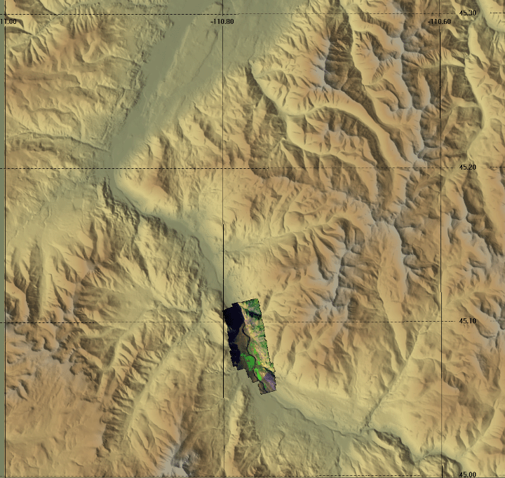
Yellowstone River north of Yellowstone NP
on the afternoon of October 12, 2006
As viewed by the FireMapper™ system
in reflected red, near-InfraRed and thermal-InfraRed light
|
|
Click on the image above to view a larger (JPEG) image
(opens a new browser window)
Images were collected from the PSW Airborne Sciences Aircraft flying over the area of the Upper Yellowstone River at 15:40 MDT.
|
| |
|
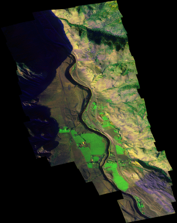
Image 1:
A portion of the image mosaic from the Upper Yellowstone River.
This RGB image shows reflected red light at 650 nm in red, reflected NIR at 850 nm in green, and thermal IR at 8 - 12 um in blue.
Download this image as a 1 meter-resolution TIFF.
|
Click on the image above to view a larger Zoomify (JPEG) image with 1 meter resolution
(opens a new browser window)
|
| |
|
| |
|
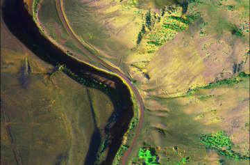
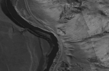
Image 2:
A portion of the image mosaic from the Upper Yellowstone River around the LaDuke hot springs.
This RGB image shows reflected red light at 650 nm in red, reflected NIR at 850 nm in green, and thermal IR at 8 - 12 um in blue. |
Click on the image above to view a larger (JPEG) image with 1 meter resolution
(opens a new browser window)
|
| |
|
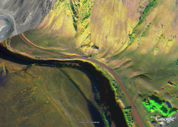
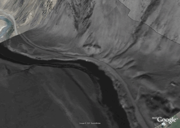
Image 2a:
A portion of the image mosaic from the Upper Yellowstone River around the LaDuke hot springs in a Google Earth overlay.

View the Hot Springs area in Google Earth.
Locations approximate, FULL resolution version (2 MB file). |
Click on the image above to view the full-resolution image
(opens a new browser window)
|
| |
|
Image 3:
A portion of the thermal IR band image mosaic from the Upper Yellowstone River around the LaDuke hot springs.
This RGB image shows reflected red light at 650 nm in red, reflected NIR at 850 nm in green, and thermal IR at 8 - 12 um in blue. |
Click on the image above to view a larger (JPEG) image with 1 meter resolution
(opens a new browser window)
|
| |
|
Image 3a:
A portion of the thermal IR band image mosaic from the Upper Yellowstone River around the LaDuke hot springs.
View the Hot Springs area in Google Earth.
Locations approximate, FULL resolution version (<1 MB file). |
Click on the image above to view the full-resolution image
(opens a new browser window)
|